

Topography app for iPhone and iPad
Developer: Georgios Graikousis
First release : 25 Mar 2013
App size: 15.83 Mb
The application is very useful to Civil Engineers, Architects, Surveyors, and those interested in measuring a surface area or converting its coordinates to UTM EGSA87.
This tool enables users to:
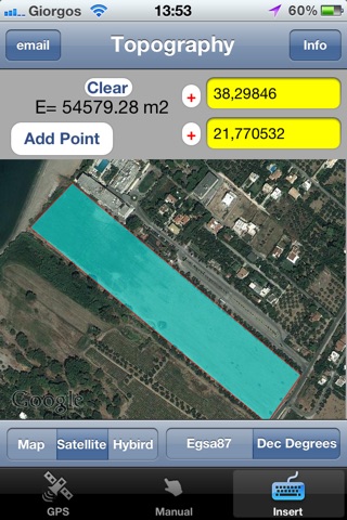
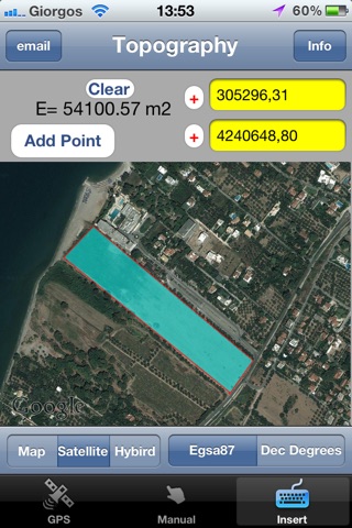
1. Convert the coordinates (x,y) to UTM EGSA87 Datum
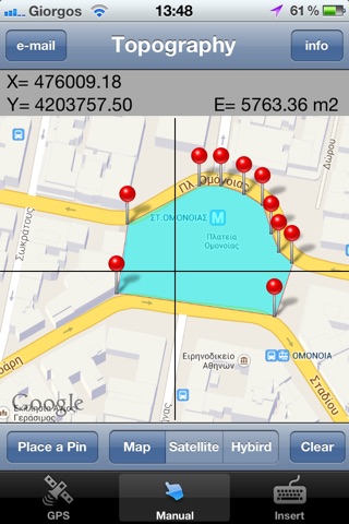
2. Calculate the area of a polygon in square meters (m2)
3. Send the above measurements by e-mail in [dxf] file format. The dxf file can be opened in a MAC or a PC by any drawing application like Autocad.
4. Send measurements by e-mail in [kml] file format. The kml file can be opened in a MAC or a PC or iPhone by GoogleEarth application.
5. Send measurements by e-mail in [TXT] file format. The text file contains coordinates either in EGSA87 Datum or Latitude and Longitude in decimal degrees.
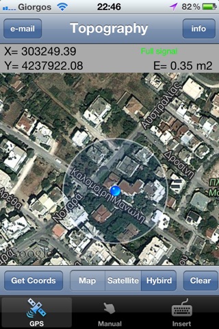
The measurements mentioned above can be provided not only by placing the iPhone in each border of a surface area, but also from distance (when users are on their bed or their sofa). Users may also have their final measurements by entering the coordinates either in EGSA87 Datum or Latitude and Longitude in decimal degrees.
Latest reviews of Topography app for iPhone and iPad
Tried to do something really complicated like drop 4 pins on the corners of my property. App was unable to figure out it was a rectangle therefore not useful. Boo
I am disappointed because the Price, Name and icon of this App, does not reflect what you can do. It is too simple and lack of features to be a good tool for Topography. Theodolite is just a few dollars more, and it is so much close to the real device need for Topography work. Improve you App please.